The Benefits of GIS in Banking
Geographic information system (GIS) technology is already being used in the banking industry and other risk-focused industries in a wide variety of ways. The World Financial Review shows how a business analyst at a local or regional bank can “open a map… and choose datasets from the U.S. Census Bureau which enables additional layers displaying employment status, income, residential status of residents, and a lot more.”
In agricultural lending, situations are apt to become more complicated. Along with all of the concerns that traditional banks have to be concerned with, ag lenders also have to keep an eye on major weather events, region-specific water rights information, and regulatory changes that can affect the farmland and parcels in their portfolios, as well as water security and commodity pricing.
Without the right data and a thorough water risk assessment, ag lenders can struggle to make sound lending decisions in a timely manner. This article explores the benefits of using GIS in banking, particularly as it relates to the agricultural sector and water security.
GIS Can Help Ag Lenders Solve Key Challenges
Because GIS technology can be applied in many different ways, GIS in banking offers ag lenders a way to solve some of their key challenges. GIS tools can be used to view and understand data on crop stress, soil health, water use and quality, and dozens of other metrics, all put together into an intuitive, easy-to-understand interface.
In addition, GIS tools can help with
- Water risk mitigation
- Customer acquisition
- Geographic expansion
- Reporting
- Borrower relationships
Access to Water Risk Information
First, access to reliable water data remains an obstacle for stakeholders at all levels, from lenders and investors to growers themselves. Water is local, its problems and risks are local, and risk mitigation strategies must be built upon granular, on-the-ground knowledge. Otherwise, it can be especially difficult for ag lenders who work in multiple regions or don’t have access to historical water data for specific watersheds or parcels of land.
In the past, lenders have had to turn to a patchwork of regional datasets or hire local consultants to provide the risk assessments that they need.
GIS tools offer a better solution by aggregating data from multiple sources in a more customizable, personal, and shareable way.
New Customer Acquisition
Ag lenders need to stay competitive in order to retain borrowers and acquire new customers. GIS gives lenders this competitive edge by providing deeper insights into water rights, land use, pumping restrictions, and other information on a parcel-by-parcel basis.
By incorporating GIS into banking practices in the agricultural sector, lenders can make use of powerful data and analytics tools that were once only available to larger entities.
As water security expert Chris Peacock explains on the NORI podcast, GIS tools help “to get data and information into the hands of everybody so that everyone can make better decisions vs. just a select few that have historically arbitraged the system.”
Geographic Expansion
Many lenders are expanding into new regions, which can present an entirely new set of challenges in the form of local environmental factors, various types of water sources, state-specific regulations, and water rights policies. GIS tools present a simple solution to this challenge by making it easy to view the boundaries of watersheds and understand pumping restrictions in groundwater basins, even in the absence of actually being there on the ground.
Lenders can use GIS research tools with layers upon layers of data and metrics to look up information on a single parcel of land. This can be done as easily as searching an APN number or by pointing and clicking on a map. With streamlined access to better information, lenders can be prepared to enter new markets without having to engage in tedious research, while factoring in region-specific data into their risk assessments.
Reporting
Using GIS in banking can help ag lenders comply with regional regulations and reporting requirements, such as those related to SGMA (the Sustainable Groundwater Management Act) in California. These requirements can be onerous without the right tools for the job, and GIS tools are a natural fit here as well.
Soon, financial institutions will be required to report on the ESG data and metrics of the assets in their portfolios. Meaning, there will need to be a way to gather and analyze that data in order to report on it. GIS will be that solution.
As the Solutions Journal puts it, “the future of water is digital.” With the help of drones, satellites, and field sensors, “surface and groundwater data within watersheds can now be collected and shared at the local, regional, and even global scales.”
The more that reporting requirements can be streamlined with the help of GIS technology, the more time ag professionals can spend on mitigating water risk and ensuring food production.
Borrower Relationships
GIS technology provides a common ground of relevant datasets that are so shareable with stakeholders throughout supply chains. Ag lenders can share this data with borrowers to encourage sustainable water use practices and strengthen ag lending relationships. These sustainable water practices can increase longevity and ROI – two incredibly important items in the current climate of water stress.
How GIS Can Help With Future Water Concerns
While today’s water concerns are complicated enough, we can expect them to be even more complex in the future in an age of water scarcity and climate change. The Federal Reserve is already warning agricultural banks to “act fast” to perform risk assessments and take steps to mitigate the impacts of climate-related risks.
If developed and implemented properly, GIS can help ag lenders identify, understand, and monitor information on:
- Water rights on a parcel-by-parcel basis
- The progress of large state-funded projects, such as dams and reservoirs, that could have an impact on future water supply sources
- Regulation data. An example is data related to SGMA, such as the boundaries of groundwater basins and their associated Groundwater Sustainability Plans
- Rainfall data for macro-catchment rainwater harvesting
- Water laws and regulations on a state-by-state basis
- Microclimate data for use in precision agriculture
- Much more
Additionally, GIS can help appraisers properly value land because it can provide a more complete understanding of the landscape with geographically-modeled data.
Other Applications of GIS in Banking
The financial sector is moving increasingly toward automation and digitization, and it’s important that agricultural banks don’t fall behind on the FinTech curve. Ag lenders can use GIS technologies to improve their risk mitigation strategies, regulatory compliance practices, and other core concerns.
GIS can also shed light on water rights and even on weather trends and macroclimate impacts like drought and water scarcity. It can be used to monitor water use, and stay on top of regulatory changes in specific basins, such as the adjudicated basins and Groundwater Sustainability Agencies in California.
Perhaps most important, it can help to get multiple stakeholders on the same page and aid in collaboration and communication between lenders, borrowers, and other agricultural professionals. Because GIS uses visual, map-based representations of data, users can present it in the appropriate format for each scenario.
GIS can help ag lenders understand the legal implications of water rights and obtain both a granular and holistic view of the water and climate risks in their entire portfolios. GIS maps make it easy to see which percentage of properties are in a water-stressed area and track parcels individually or as a group.
With access to more easily-digestible water information, ag lenders and investors can reduce their risk while helping farms stay resilient in times of water stress and transition to more water-friendly practices. The two are one and the same.
Read more about GIS and its benefits in the GIS in Agriculture Guide.
The Bottom Line
Financial regulators are increasingly expecting banks to perform climate-related stress tests and make appropriate disclosures to investors. Ag lenders can get ahead of the curve by using GIS tools to identify, understand, monitor, and mitigate water risk.
GIS tools can display everything from macro weather trends to parcel-specific insights in an easy-to-use, map-based format that’s suitable for all stakeholders. In addition to helping ag professionals meet their regulatory reporting requirements and monitor their water use, they can also help appraisers make more accurate land valuations.
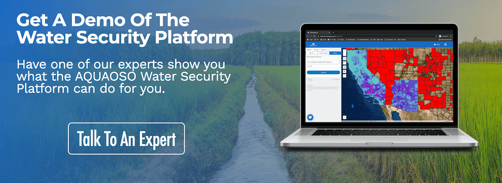
Sign up for our newsletter to stay on top of water risk trends, or contact us directly for a free chat and demo of our Water Security Platform.
Recent Posts
Agcor and AgWare Celebrate 2 Years of Groundbreaking Integration, Setting the Standard in Agricultural Appraisal Efficiency
PRESS RELEASE For Immediate Release DENVER, March 21, 2024 -- Agcor, an AQUAOSO Technologies, PBC brand, a leading provider of agricultural lending software solutions, announces a significant milestone in its partnership with AgWare, a premier developer of innovative...
AQUAOSO launches Agcor – a full suite of digital tools for the modern ag lender.
PRESS RELEASE For Immediate Release Denver, CO - Today, AQUAOSO Technologies, PBC officially unveiled Agcor™ - a suite of software tools for the modern ag lender. The software is purpose-built by and for agricultural lenders to unlock the power of...
AQUAOSO’s Climate Intelligence Platform Showcased At OnRamp Conference
PRESS RELEASE For Immediate Release AQUAOSO showcases GIS Connect, a climate intelligence platform that helps US financial institutions mitigate climate risk during the recent OnRamp Agriculture conference. AQUAOSO shares their story of substantial growth as...


