ESG Data Collection for Agricultural Finance with GIS

ESG reporting is quickly becoming an expectation and will soon be a legal requirement in many sectors, including agricultural finance.
As these reporting needs become more complex, financial institutions and other ag professionals with a comprehensive approach to ESG data collection will be better positioned to stay competitive and reduce risk.
But because ESG metrics vary widely from portfolio to portfolio – even parcel to parcel – traditional data collection methods aren’t always suitable. They can be expensive and time-consuming and require a considerable amount of manual work. Institutions can use GIS technology to gather better, more precise data and make sense of their diverse portfolios.
This post will explore the ways that ESG reporting can be streamlined using GIS data, especially when it comes to water security in the agricultural sector.
The Importance of ESG Data Collection and Reporting
ESG refers to the metrics that companies use to report their performance in three key areas: Environmental, Social, and Governance. These metrics help investors choose which companies to invest in based on specific criteria – such as diversity and sustainability – or their ability to withstand risks associated with climate change.
New disclosure requirements are increasing the pressure on companies to release more transparent ESG reports, and third-party ratings are falling out of favor. Increasingly, investors want direct access to ESG data so that they can assess it using their own criteria. This has created a need for more standardized ESG data collection.
When it comes to agriculture, banks and ag lenders can use ESG data to determine the overall level of water risk across their lending portfolios. But financial institutions need a consistent ESG strategy in order to truly measure the impact of their investments. Without the right data, it’s hard to understand what’s being measured.
ESG Data Collection Using GIS Technology
ESG data collection and reporting is a relatively new process for many businesses, and regulatory requirements are rolling out at a different pace in the U.S. and Europe. This means companies that refine their ESG practices now will be ahead of the curve. In an article on six key ESG challenges, PricewaterhouseCoopers puts it this way:
“Doing too little or waiting too long to address the most material ESG issues will result in companies having to play catch-up to their peers and investors potentially seeing the value of their assets being challenged over time.”
ESG reporting will require analyzing complex metrics from nebulous data sources that, in some cases, haven’t even been determined yet. In addition, these reports need to be easy to share and update with new data in real-time. This calls for an adaptable, fluid technology that can link disparate pieces of data into an easy-to-understand whole.
GIS (geographic information system) technology can play exactly this role and serve as the engine behind ESG reporting. By using its interactive, customizable interface, businesses and financial institutions can layer multiple datasets together – such as water sources, weather patterns, and other environmental data – to identify connections that wouldn’t be visible using more traditional reporting formats.
How to Use GIS Data in ESG Reports
Currently, companies are attempting to navigate ESG reporting expectations in different ways. That’s because there are many different ideas about how to assess ESG data. As Bloomberg explains, some “data points may be reported [differently] across companies in the same sector” and “could be reported [differently] by the same company from one year to the next” – making it more challenging for investors to interpret this data.
By leveraging GIS technology, stakeholders can put together a more complete picture at multiple levels of resolution. They can be flexible during the heating and cooling process of ESG reporting requirements that are yet to be solidified.
GIS tools allow users to understand and contextualize their data on multiple levels – for example, analyzing water risk with borrower-specific context for a parcel of land – and to add or remove relevant data points, such as regulatory boundaries, weather patterns, and more.
GIS allows ESG data to be fluid and accurate by being built from the aggregation of granular datasets. This is a good thing.
GIS can help to identify physical and material risks caused by drought and other natural disasters. Companies can also incorporate real-time data from stakeholders up and down the supply chain, such as field sensors that monitor water use in agriculture.
Because of its various applications, GIS data can be used to mitigate all types of ESG risks, including risks to social, natural, and financial capital.
For example, ag bankers can use GIS tools to help with new customer acquisition, geographic expansion, and other social and cultural ESG goals – not just environmental initiatives. This helps to strengthen relationships with borrowers and contribute to their financial success.
The Real-World Benefits of ESG Data Collection
There’s no one-size-fits-all approach to ESG data collection, in part because different investors may prioritize different areas. One thing that most ESG initiatives are designed to address is that climate change “presents clear systemic risks to U.S. financial markets.”
According to the Federal Reserve, “agriculture is among the most at-risk sectors,” due to its reliance on natural resources and weather patterns. As a result, ESG data can be especially useful in this sector to mitigate climate risk, protect water resources, and contribute to a healthier ecosystem and reliable food supply.
Lenders and investors can use this data to inform their financial decisions, particularly when assessing a land deal in a vulnerable watershed, or understanding how water stress can impact the viability of a farming operation in their portfolio. Growers, too, can benefit from access to this data, and use it to make better planting decisions in light of changing weather patterns and increased climate risk.
ESG data collection isn’t just about checking the boxes to meet mandatory reporting requirements – it’s also about fostering better collaboration between stakeholders to build a more sustainable agricultural system and a resilient water supply.
Read more about ESG reporting and capital risk in the explorable AQUAOSO Guide.
The Bottom Line
ESG reporting requirements are becoming more complex. Investors want access to more transparent datasets, while governments are increasingly requiring banks and other financial institutions to disclose climate risk across their portfolios.
Using GIS technology is one of the most effective ways to meet both new reporting requirements and stakeholder expectations. But developing an ESG data collection strategy from scratch can be time-consuming and expensive.
This is why GIS is so important. Ag professionals can get access to all of the data they need in one place in the context of each parcel in each portfolio without having to assemble it all by hand.
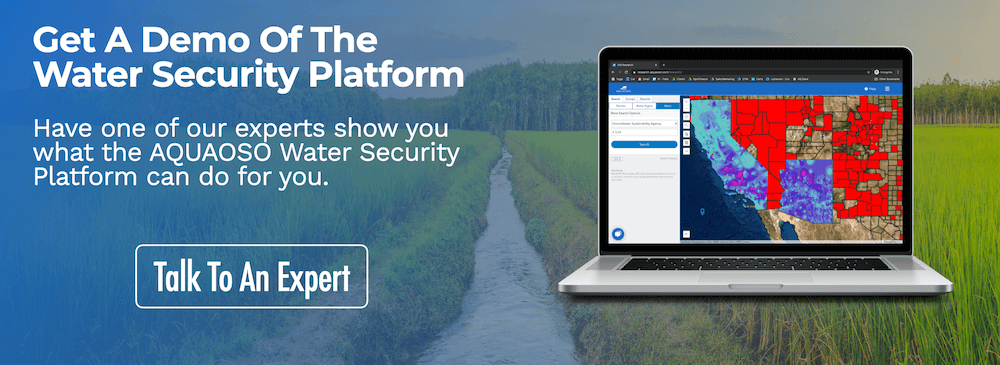
AQUAOSO’s Water Security Platform combines data from multiple sources into a customizable interface that can be updated in real-time and shared with other stakeholders.
Contact the team for a free demo, or head to the resources page to learn more about the benefits of ESG data collection with GIS.
Recent Posts
Agcor and AgWare Celebrate 2 Years of Groundbreaking Integration, Setting the Standard in Agricultural Appraisal Efficiency
PRESS RELEASE For Immediate Release DENVER, March 21, 2024 -- Agcor, an AQUAOSO Technologies, PBC brand, a leading provider of agricultural lending software solutions, announces a significant milestone in its partnership with AgWare, a premier developer of innovative...
AQUAOSO launches Agcor – a full suite of digital tools for the modern ag lender.
PRESS RELEASE For Immediate Release Denver, CO - Today, AQUAOSO Technologies, PBC officially unveiled Agcor™ - a suite of software tools for the modern ag lender. The software is purpose-built by and for agricultural lenders to unlock the power of...
AQUAOSO’s Climate Intelligence Platform Showcased At OnRamp Conference
PRESS RELEASE For Immediate Release AQUAOSO showcases GIS Connect, a climate intelligence platform that helps US financial institutions mitigate climate risk during the recent OnRamp Agriculture conference. AQUAOSO shares their story of substantial growth as...