Using GIS as an ESG Data Provider in Agricultural Lending

GIS (or, geospatial information system) technology has a wide range of applications in the agricultural sector, from predicting crop-specific water needs, to monitoring soil quality and crop health, to improving water use efficiency. GIS software can use data from satellites, drones, and field sensors, paired with portfolio and parcel data to provide a comprehensive picture of a particular region or parcel of farmland. It’s also especially well-suited to serving as an ESG data provider.
As ESG reporting becomes mandatory for many businesses and financial institutions, being able to provide accurate, real-time data with portfolio-specific context will be imperative. Not only can GIS help companies meet their legal reporting requirements, but it can also make them more appealing to investors who want to ensure the sustainability of their portfolio.
This post will explore ways that GIS can be used as an ESG data provider, and how it can be customized to meet the needs of the agricultural industry in particular.
Why GIS Is the Future of Data Collection
Data collection has come a long way in recent decades. Now, many farmers routinely use smart tractors, drones, and IoT devices to gather data that wasn’t easily available just a few years ago. This allows them to boost crop yields and reduce water use by tailoring inputs and outputs to precisely align with current growing conditions.
Publicly available datasets such as rainfall and snowpack data can assist in the understanding of changing weather patterns, drought, and other contributors to water stress. Ag lenders and investors can use this data too, to ensure that the farming operations or parcels of land they invest in have access to sufficient water resources to remain viable in the face of climate change.
The problem is, without GIS, this data may come in the form of disparate datasets that require significant time and money to decipher. What’s more, the data is not organized in the context of individual parcels in a portfolio. With GIS, this contextualization is possible and it gives ag lenders a competitive advantage.
GIS data may also provide insight into physical risks that could impact the security of a lending or investment portfolio. Understanding these risks will be important in meeting ESG goals and protecting assets from water risk.
How ESG Reporting Requirements Are Changing
ESG reporting practices are still being ironed out in many parts of the world. In the U.S., ESG ratings are usually determined by third-party agencies, but investors increasingly want access to companies’ ESG data themselves.
The ability to independently assess the sustainability of an agriculture loan portfolio is important. Given the locality of each parcel in each portfolio, in-house measurement makes more sense and can be far less expensive than third-party agencies. This allows users to utilize their own tools and scoring systems to assess the sustainability of a given organization in order to report for standardized reporting requirements.
Europe has already taken steps to standardize ESG reporting metrics, and the U.S. is expected to follow suit. According to Bloomberg,
“The SASB [Sustainability Accounting Standards Board] recently released 77 industry-specific accounting standards that help investors understand how material sustainability issues can impact a company’s financial performance…. This influx of unstructured data presents a need for a data provider to package and present this information in an easily consumable format.”
How GIS Tools Can Help
GIS is a natural fit for this role due to its versatility. After all, ESG metrics are incredibly varied (encompassing environmental, social, and governance issues) and are applied differently in different industries. As PricewaterhouseCoopers explains,
“[ESG] covers social issues like a company’s labor practices, talent management, product safety and data security… board diversity, executive pay and business ethics. But, there is a divide amongst stakeholders on how to manage and communicate it and what the term even means.”
The customizable nature of GIS makes it an excellent choice for financial institutions that have to gather information from multiple datasets to assess their diverse portfolios. For example, ag banks can use GIS to understand the state-specific regulations that impact borrowers or perform a water risk assessment before approving a loan.
GIS is especially useful in agriculture, where the viability of a particular piece of land or the sustainability of a water source can vary on a parcel-by-parcel basis. An impending drought may exacerbate this variation.
Organizations that are proactively gathering and analyzing GIS data will be able to use these tools as an in-house ESG data provider to meet new reporting requirements.
Using GIS As An In-House ESG Data Provider
Because ESG reporting requirements are yet to be determined, many organizations are unsure how to prepare for them. Some may choose to hire expensive consultants to do the work for them, assembling nebulous datasets into an easy-to-understand report.
But with the right GIS tools, organizations can perform this work in-house, saving them time and money and giving them an advantage of speed and cost savings.
They’ll be able to lead the charge and create reporting strategies that work for them and their portfolios, rather than having to catch up once reporting requirements are implemented. GIS tools provide a degree of preparedness and flexibility that traditional resilience strategies do not.
ESG Reporting and Water Risk
One issue that is becoming central to ESG reporting is water stress. In their “Investor Handbook for Water Risk Integration,” Ceres makes the case that “Integration of water into portfolio management and overall strategic practices is an essential element for a deeper understanding of material investment risks.”
Ag professionals can use water GIS data to visualize these risks in the form of maps that compile soil quality, crop patterns, irrigation districts, watershed boundaries, and more. They can then share these reports with other stakeholders in order to foster a collaborative approach toward water conservation and other ESG initiatives.
GIS can be a step toward a more equitable, transparent agricultural system – in which stakeholders at all levels have access to the data they need to make better financial decisions, protect natural, social, and financial capital, and contribute to the well-being of the planet.
Learn more about ESG reporting and capital risk in the explorable AQUAOSO Guide.
The Bottom Line
ESG reporting requirements are a vital tool for mitigating climate risks, but they add a level of complexity that many organizations aren’t equipped to handle. GIS tools offer a solution for meeting these requirements in-house, because of their ability to represent data from multiple sources in a flexible, customizable format.
Financial institutions and other organizations can get a head-start on ESG disclosure practices by using GIS tools as an ESG data provider. In particular, ag professionals can benefit from using AQUAOSO’S GIS tools to identify and mitigate water risk.
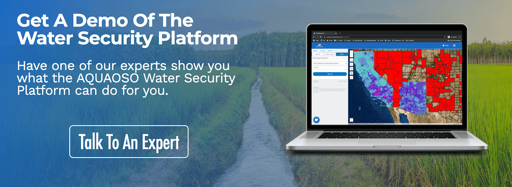
With the Research and Reporting platform, users can access data on water supply, crop-specific water needs, natural disasters, water and soil quality, water rights information, watershed boundaries, and more – all in an intuitive map-based format that can be shared with other stakeholders.
Schedule a free demo to see the platform in action, or visit the resources page to find out more about GIS in agriculture and other related topics.
Recent Posts
Agcor and AgWare Celebrate 2 Years of Groundbreaking Integration, Setting the Standard in Agricultural Appraisal Efficiency
PRESS RELEASE For Immediate Release DENVER, March 21, 2024 -- Agcor, an AQUAOSO Technologies, PBC brand, a leading provider of agricultural lending software solutions, announces a significant milestone in its partnership with AgWare, a premier developer of innovative...
AQUAOSO launches Agcor – a full suite of digital tools for the modern ag lender.
PRESS RELEASE For Immediate Release Denver, CO - Today, AQUAOSO Technologies, PBC officially unveiled Agcor™ - a suite of software tools for the modern ag lender. The software is purpose-built by and for agricultural lenders to unlock the power of...
AQUAOSO’s Climate Intelligence Platform Showcased At OnRamp Conference
PRESS RELEASE For Immediate Release AQUAOSO showcases GIS Connect, a climate intelligence platform that helps US financial institutions mitigate climate risk during the recent OnRamp Agriculture conference. AQUAOSO shares their story of substantial growth as...