Using Groundwater GIS Data to Mitigate SGMA Risks

Like many parts of the American West, the agricultural industry in California faces an increased risk of drought and extreme weather events in the face of climate change. While each state has its own water rights policies in place, many of them are being revised or expanded to address aquifer depletion and other water risks.
The Bottom Line
In California, the most notable change is the implementation of SGMA (the Sustainable Groundwater Management Act), which requires each groundwater basin in the state to develop its own water use regulations and pumping restrictions. These regulations may result in decreased water allocations for farmers, as well as increased competition for water resources and higher water prices on the open market.
By using groundwater GIS data to monitor and assess water resources, ag lenders and other ag professionals can stay ahead of the curve when it comes to water risk and take steps to minimize the financial impacts of policies like SGMA. Users can obtain a more complete picture of a farming operation’s reliance on groundwater resources and its overall water risk.

SGMA’s Impact on Groundwater Use
Water is local. In order to stay competitive under SGMA, ag lenders and investors need to be aware of the risks that are material to their lending portfolios. These risks vary from basin to basin between different parcels in the same basin, depending on a grower’s access to water resources the seniority of their water rights, and more.
In many cases, growers will need to monitor their groundwater usage more closely in order to adhere to pumping restrictions and reporting requirements. They may also find themselves seeking alternative water sources if allocations are reduced or if groundwater levels drop below the depth of existing wells.
According to the Sacramento Bee, groundwater pumping during the 2017 drought led to a “deficit large enough to fill an empty Shasta Lake seven times.” Some farmers turned to water markets, where they paid four times as much as usual to maintain their crops, rendering some of their most profitable crops no longer viable.
In order to reduce these risks, ag lenders can work with their borrowers to develop a water security strategy in advance, which may include investing in practices that build resilience. By using data-driven intelligence to inform these decisions, stakeholders at all levels can work together to mitigate water risk across the agricultural sector.
How to Use Groundwater GIS Data to Identify and Mitigate Risks
Because water rights and water allocations can vary widely from parcel to parcel, ag lenders need to be able to assess water risk at a granular level to account for all of the borrowers in their portfolios. Groundwater GIS data can be a key tool for tracking these risks over time and sharing insights with relevant stakeholders.
Ag professionals can take the following steps to integrate groundwater GIS data into their overall water risk assessments:
1. Identify which GSA (Groundwater Sustainability Agency) a parcel is in
Since SGMA restrictions are implemented at the watershed level, it’s important to know which groundwater basin a parcel is located in. In addition to general insights, such as whether or not a farm is in a critically overdrafted basin, this information can provide a glimpse of what pumping restrictions are on the horizon.
According to the Water Education Foundation, “Forty-three plans representing 18 of the [San Joaquin] Valley’s most critically overdrafted groundwater basins … are in the hands of the California Department of Water Resources (DWR) for review.” These plans rely on a broad range of strategies, from groundwater banks to spillway enlargement projects, to address aquifer depletion and mitigate water stress.
Knowing which GSA a parcel of farmland is in, and which strategies that GSA is likely to implement, is the first step to gathering actionable groundwater GIS data.
2. Research Groundwater Depth and Well Reports
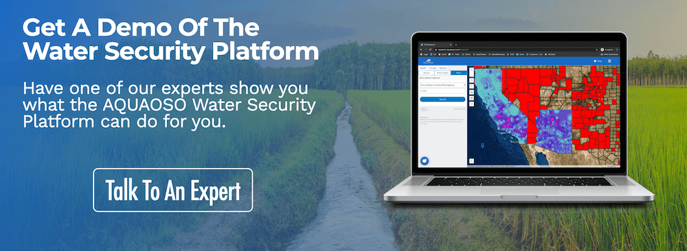
Next, ag professionals can turn to groundwater depth and well report data to determine whether a farm’s water resources are likely to be sufficient for the year ahead. GIS tools like AQUAOSO’s Water Security Platform can provide both of these data points on a single map, making it easier to assess a parcel’s water security situation.
For example, if the groundwater depth is 250 feet and the well depth is only 200 feet, the well can be expected to run dry. On the other hand, if groundwater levels are too shallow, this can lead to water quality issues such as contaminated groundwater. Ag professionals can use GIS tools to check water quality data and ask for a pump test report to confirm that groundwater resources will be usable.
3. Check Surface Water Supply
Lenders can look up what water district a parcel is in, as well as what water rights are associated with a particular parcel of land, to find out what additional water sources it has access to and how reliant a property or region is on groundwater. If a property has access to multiple sources of water, including water markets, then it will be more resilient in times of water scarcity.
4. Explore Additional GIS Data
Finally, ag lenders can use GIS data to explore additional risk factors, such as saltwater intrusion and land subsidence, that can impact soil and water quality. GIS platforms can help users understand what’s happening underneath the ground, as well as keep tabs on regional pumping restrictions and the state of critically-overdrafted basins.
Risk factors aren’t the only data points worth monitoring, however. It’s just as important to identify risk mitigation strategies that borrowers can put into practice. For example, some basins have groundwater banking and aquifer recharge programs that provide financial incentives for growers to reduce their water use.
GIS Gives A Portfolio and Parcel-Centric Picture
GIS technology can align portfolio data with a tailored story of risk.
By presenting a full and complete picture of a parcel’s water risk — and by extension, the overall risk in a lending portfolio — GIS software can help ag professionals make better decisions and protect their assets from physical and material water risk.
Contact the team at AQUAOSO to learn more about lowering water risk in agriculture lending portfolios, or download the free 2021 white paper “Is California Agriculture Prepared for Another Drought?” here.
Recent Posts
Agcor and AgWare Celebrate 2 Years of Groundbreaking Integration, Setting the Standard in Agricultural Appraisal Efficiency
PRESS RELEASE For Immediate Release DENVER, March 21, 2024 -- Agcor, an AQUAOSO Technologies, PBC brand, a leading provider of agricultural lending software solutions, announces a significant milestone in its partnership with AgWare, a premier developer of innovative...
AQUAOSO launches Agcor – a full suite of digital tools for the modern ag lender.
PRESS RELEASE For Immediate Release Denver, CO - Today, AQUAOSO Technologies, PBC officially unveiled Agcor™ - a suite of software tools for the modern ag lender. The software is purpose-built by and for agricultural lenders to unlock the power of...
AQUAOSO’s Climate Intelligence Platform Showcased At OnRamp Conference
PRESS RELEASE For Immediate Release AQUAOSO showcases GIS Connect, a climate intelligence platform that helps US financial institutions mitigate climate risk during the recent OnRamp Agriculture conference. AQUAOSO shares their story of substantial growth as...