Leveraging California Water Districts GIS To Understand Water Risk In Ag

Geographic information systems are becoming increasingly important to agricultural professionals in California, especially in the understanding of water risk and how that applies to specific water districts. While GIS tools can be useful for understanding water rights and water scarcity issues in any given state, California’s unique set of regulations (SGMA) presents some unique challenges.
Because California’s groundwater management policies are so complex, being able to represent them visually on a map can set ag professionals apart from others because it enhances and quickens their understanding of these policies.
Using GIS to understand California water districts allows for more speed and accuracy when conducting due diligence during a loan approval process or when researching an investment. Ultimately, it can help to mitigate the overall water risk of a loan portfolio or growing operation.
This article examines how California water districts GIS tools can help ag lenders and other stakeholders gain a thorough understanding of water security issues in the state, as well as how to use this knowledge to make better business decisions.
SGMA Makes the California Water Situation More Complicated
California is a state with one of the most complex systems of water rights and regulations in the U.S. As a general rule, most states use either an appropriative or a riparian water rights system, but California uses a hybrid of the two. In some cases, California water rights are ranked in order of seniority, or priority date. In others, factors such as whether or not a piece of land has been subdivided can determine whether or not water rights are still valid.
In addition to navigating a complex water rights system, California water users have to compete during a time of water stress, increased drought, and reduced snowpack – negative drivers that are impacted by climate change, which drives up competition for already scarce resources. They must also stay diligent with reporting and monitoring requirements under SGMA (the Sustainable Groundwater Management Act), which caps groundwater pumping in some basins.
Taken together, this puts pressure on ag professionals at all levels – from lenders to growers to investors – to have a thorough understanding of California water districts.
GIS tools can make this easier by enabling users to layer multiple sets of data onto a single map. Instead of the separated data inflow that comes from individual maps and charts, users gain a layered and integrated understanding of data through an explorable, geospatial representation.
For example, users could view information of California water districts using GIS with additional datasets, such as groundwater depth, soil quality, GSAs, SGMA priority basins, and more – all layered with the water district data.
This gives a visual representation of how complex datasets interplay with each other. This understanding can inform decisions around water risk mitigation, maintain competitiveness, and drive business success.
California water districts GIS maps are quick to set up and easy to understand. Many ag professionals have already started to use them as part of their research and water risk assessments, so adapting GIS technology helps ag professionals stay competitive. Having reliable access to water data sets businesses apart and allows them to make smarter, quicker, educated, and more sustainable decisions that can bolster the longevity of financial health.
California Water Districts GIS and Fluid Functionality
The water situation in California is constantly changing as climate change influences the region’s rainfall and snowpack, as groundwater resources diminish due to water stress, and as Groundwater Sustainability Agencies roll out their sustainability plans and pumping allocations.
GIS technology is fluid to match the variability in external factors. It can be tailored to meet specific research needs or to incorporate new datasets over time. Users can render representations of California water districts, complex relationships between regulation systems, such as weather, human activity, or wildlife.
As one example, the USC Dornsife Spatial Sciences Institute shows how GIS can be used to improve the accuracy of a wind farm assessment:
“When assessing possible wind farm locations in two dimensions, a bird’s migratory path might make a location seem inaccessible. However, reviewing that same space using 3D GIS data may reveal that the elevation of birds’ flight paths and the height of the wind farm are compatible.”
Ag professionals can use GIS technology to gain insight into water security and other agricultural issues. One study used GIS to track agricultural runoff, while the USDA uses Digital Soil Mapping to represent soil quality and type:
“The most exciting aspects of digital soil mapping relate to the ability to depict smaller segments of the landscape for traditional soil classes… These are capabilities that will allow soil scientists to more completely and thoroughly represent their soil knowledge to users.”
Put plainly, GIS tools allow for the representation of the integration of granular datasets and provide knowledge that can be common ground between stakeholders so that the right decisions can be made.
California water districts GIS data can help growers better address water security risks and comply with SGMA reporting requirements.
The more water data that an ag professional can collect and manage digitally, the less time they have to spend on manual research for reporting purposes. Lenders and investors can use GIS to perform due diligence before approving a land deal or another investment, reducing the need for on-the-ground research and tedious data management.
Read more about GIS in Agriculture in our explorable guide.
The Bottom Line
California’s complex system of water rights and basin-specific regulations can make it a challenging state for ag professionals to grow in or invest in. GIS technology is an optimal way for stakeholders to get a deeper understanding of California’s water districts because it allows users to explore other related water security issues in the same place. It is the side-by-site perspective of multiple sets of granular data that aids a real understanding.
From straightforward projects such as researching the boundaries of a watershed, to more complex needs like assessing a parcel’s water risk or soil quality, GIS can help users gather, represent, and visualize data in an easy-to-understand way.
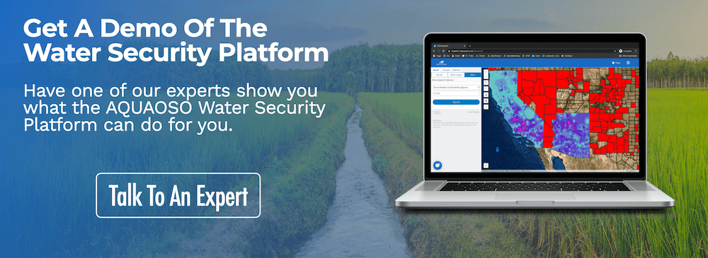
Visit our resources page to learn more about SGMA and other California water rights issues, or reach out to us for a demo of our geospatial Water Security Platform.
Recent Posts

Sustainable Agriculture Practices That Need Financial Capital
In late 2021, world leaders gathered in Glasgow for COP26, better known as the UN’s climate change conference. With over 25,000 attendees meeting to discuss the efforts needed to address climate change, themes of sustainability, renewable energy and the reduction of...

2022 Sustainable Agriculture Trends for Ag Finance to Be Aware of
With real-world impacts like rising global temperatures, climate change is one of the biggest risk factors agriculture faces today. NOAA reported that 2020 was the second warmest year and the EPA explains a consistent increase of 0.16°F in average surface temperature...

Crucial Ways Agricultural Bank Services Can Contribute to A Sustainable Ag Economy
Ag banks and Farm Credits, enable agribusinesses to attain the financing they need in order to execute functions like harvesting and planting, as well as buying new equipment and combat overhead costs. They allow farmers to operate by engaging in a relationship with...